Delphine Ducros discusses the latest research with colleagues which saw how a suite of modelling tools can be used to identify and protect remote, data-poor natural areas in regions that are in need of urgent conservation policy.
The challenge of sampling remote areas
Human footprint is increasing worldwide, reaching even the most remote places, with potential threats to biodiversity. In isolated places, assessing and anticipating these threats by monitoring biodiversity often pose serious logistical and feasability concerns for wildlife managers.
How can we cost-effectively assess biodiversity of these remote yet fragile places so that this data can immediately contribute to conservation ?
This was the big question local managers (from Direction de la Conservation de la Faune et des Aires Protégées African Parks – DFAP) asked a French researcher team composed of the OFB (Office Français de la Biodiversité), the research institute of Tour du Valat and the IRD.
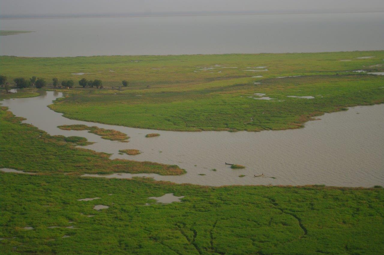
The idea was to define a protected area in the biodiversity-rich zone of the Bahr Salamat floodplain, a still pristine yet increasingly populated area of southern Chad, while minimising the repercussions on the local communities and despite very little available data at the onset of the project.
Sampling remote floodplains: Is there a way?
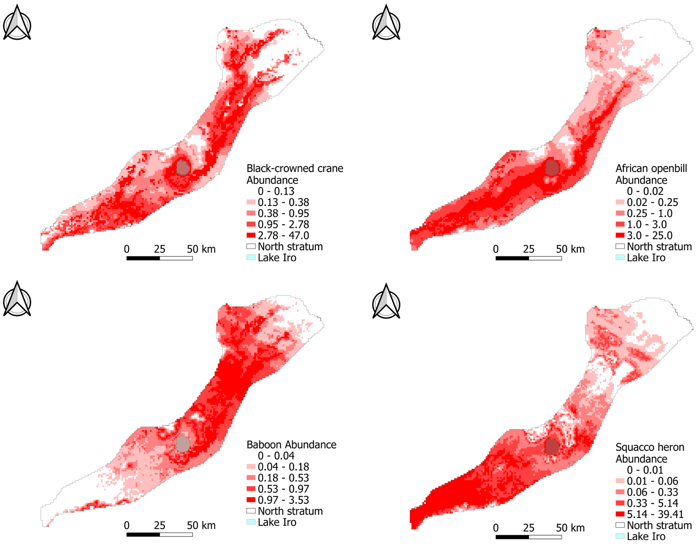
The Bahr Salamat floodplain is vast, spreading over more than 50,000 km², and host many wildlife species classified in the IUCN (International Union for Conservation of Nature) red list, such as vultures, hippo, black-crowned crane, or northern ground hornbill.
Despite their likely ecological importance, wildlife within this vast and inaccessible floodplain was never comprehensively sampled, due to an extremely limited track network. However, if birds and mammals cannot be adequately sampled from the ground, they can be from the air !
In order to have a spatially homogeneous knowledge of wildlife distribution and thus know where to best propose a protected area, we used the African Parks aircraft.
Sampling from the air
Pierre Defos du Rau from OFB supported by Ib Krag Petersen from Aarhus University, Yves Kayser and Nicolas Vincent-Martin from Tour du Valat and M’Baïti Narcisse Djimasngar from DFAP carried out aerial surveys of this remote Salamat floodplain from 2017 to 2020 using a systematic transects design to ensure uniform coverage probability of the whole study area.
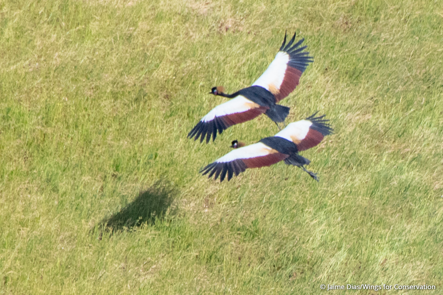
Data recorded vocally allowed to model the distribution of wildlife all over the study area, by linking our observations to factors that may influence either or both the detection and the actual presence of animals through Distance sampling and Density surface models.
Designing protected area scenarios
Then came the time for Delphine Ducros and Pierre Defos du Rau (OFB), Rodolphe Devillers (IRD), Marie Suet and Clémence Deschamps (Tour du Valat) to integrate wildlife data but also human distribution layers into protected area design tools!
Indeed, several villages or nomadic camps can be found all over the area. Local communities practice fishing, livestock rearing and agriculture. Thus, our Protected Area design proposals had to mitigate as much as possible the impacts on human activities, by trying as much as possible to exclude villages and agricultural lands from the protected area potential designs.

Using a conservation planning tool (Marxan), Delphine and Rodolphe identified alternative designs containing core and buffer areas, that could meet conservation objectives at minimal socio-economic cost.
Then, in permanent concertation with the local managers, we refined a selection of protected area designs offering different strategic orientations to decision-makers.

Cooperation between actors is key!
The permanent dialogue between local managers and the OFB/IRD/Tour du Valat modelling team was central in identifying a selection of proposed protected area designs. Together, we started from an almost total lack of data on wildlife distribution in the Salamat floodplain, Chad, to 5949 wildlife records enabling the identification of an array of protected area designs accounting for human activities.
We hope this work can inspire others having to build protected area designs at relatively short notice in remote areas.
Read the full article “Planning from scratch: A new modelling approach for designing protected areas in remote, data-poor regions” in Journal of Applied Ecology