Nicolas ‘Niko’ Dubreuil, a veteran polar explorer with over three decades of experience in the Arctic, knows first-hand the dangers of navigating the region’s icy landscapes.
In 2001, while trekking on an icepack in Greenland, he suffered a severe fall, sustaining major injuries. Instead of being deterred though, the experience left him captivated by the Arctic.
“I adopted the Greenlandic motto ‘Only time and ice are masters’ and decided to leave my life in France, relocate to a small village in northern Greenland, and learn the traditional Greenlandic way of living,” he said.
Today, from Kullorsuaq, a village in northern Greenland, Dubreuil runs a bespoke tour operator service offering expeditions for tourists, film crews and scientists wanting to learn more about sea ice and icebergs.
One of Dubreuil’s latest adventures involves training hunters from the area to plant GPS probes on icebergs. Their unique skills and knowledge of the ice are being used to assist a team led by fellow Frenchman Laurent Bertino, a mathematician at the Nansen Environmental and Remote Sensing Center (NERSC) in Bergen, Norway.
These exploits are part of an ambitious EU-funded initiative aimed at making it safer for ships to navigate the Arctic seas.
Iceberg warnings
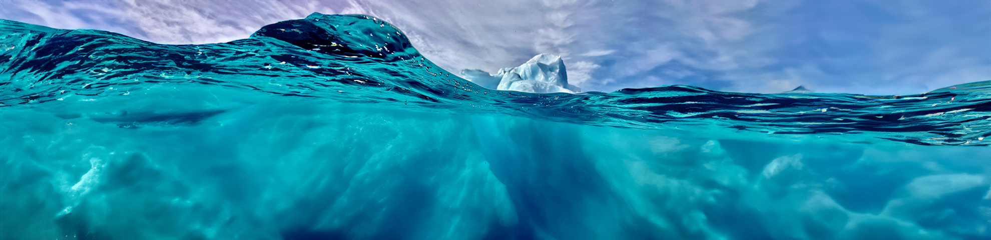
The Arctic is undergoing significant changes due to climate change, with rising temperatures leading to declining sea ice coverage, thinner ice, and increased glacier calving, leading to more icebergs.
“
The Arctic navigation season is much longer today than 20 years ago. It is also much more variable.
Over the past few decades, satellite observations have shown that Arctic summer sea ice has been shrinking at a rate of about 13% per decade, with 2023 ranking among the lowest extents on record. The greatest danger to ships is in the spring and summer, when ice sheets fracture and drift, creating hazardous sheets of floating ice called ice floes.
In a partnership that includes the Norwegian Meteorological Institute, the European Centre for Medium-Range Weather Forecasts, Mercator Ocean International, the Italian National Research Council, the Technical University of Istanbul and the Danish Meteorological Institute, NERSC is coordinating an international research effort called ACCIBERG that will run from January 2023 to December 2026.
Accurate forecasting
The ACCIBERG team is monitoring sea ice and icebergs across the Arctic using satellite data from the Copernicus network. These satellites also provide ocean and wave information, which is integrated into forecasting models to predict iceberg drift.
Their goal is to significantly improve the accuracy and reliability of navigational information for shipping in the Arctic region by developing two freely available forecasting prototypes. One provides sea ice forecasts from days to months ahead with indications of uncertainty, and the second is able to provide an iceberg trajectory forecast computed on demand. The GPS tags on icebergs will be used to improve the forecast model.
One of the biggest challenges is delivering timely and accurate forecasts to ships at sea. Currently, onshore teams often send image files via email – a cumbersome process, especially given the limited internet connectivity in remote Arctic waters.
“The only information for sailors on board ships is satellite data from two or three days ago. That’s useful, but the situation can change fast because their safety relies on crew members having the time and expertise to interpret it,” said Bertino.
Shipping route expansion
By improving probabilistic forecasting, the ACCIBERG team hopes to provide sailors with clearer risk assessments and better windows for safe passage. They are working closely with end users, such as the Norwegian and Greenland Ice Service, to refine and test these technologies.
Keld Qvistgaard is a senior ice specialist with the Greenland Ice Service, a specialised division within the Danish Meteorological Institute that focuses on monitoring and analysing sea ice conditions around Greenland. He is an active partner in the ACCIBERG team.
“Shipping is increasing, and user needs and requirements are also changing. There is a huge need for advancing technologies for ice monitoring and forecasting,” he said.
“
There is a huge need for advancing technologies for ice monitoring and forecasting.
Research from the Arctic Council suggests a 37% increase in shipping over the past decade, with projections indicating further growth by 2050 as melting ice opens new routes.
Three passages – the North-West Passage (via Greenland and Canada), the Northern Sea Route (via Russia) and the Transpolar Sea Route (via Iceland) – each offer potentially faster and cheaper cargo transport.
Yet Arctic navigation remains treacherous. Even with the assistance of icebreakers – massive steel-hulled ships designed to cut through ice – unexpected conditions can pose serious risks.
In November 2021, an unusual weather event in the East Siberian Sea triggered an early and intense sea ice formation known as a rapid refreeze. Over 20 vessels became trapped in thick pack ice, requiring a long and expensive rescue operation.
“The Arctic navigation season is much longer today than 20 years ago. It is also much more variable,” said Bertino.
Navigating the future
Beyond improving existing products from the Copernicus Marine and Climate Change Services, the ACCIBERG team is also developing new open-source forecasting software.
In the future, these forecasts could be incorporated into digital navigation systems to further enhance Arctic safety in close cooperation with the Copernicus Arctic Hub.
Officially launched in October 2023, the Copernicus Arctic Hub serves as a centralised platform providing access to a wide range of data and information on the Arctic to support evidence-based decision-making and sustainable management practices.
For now though, Bertino sees the benefits of improved forecasting extending beyond commercial shipping.
“It’s not just about economics – it’s about supporting the people who live and work in the Arctic,” he said.
It’s a sentiment echoed by his compatriot, Niko Dubreuil, back in Greenland where drifting icebergs also pose a real danger to local communities. This is part of the reason that they are happy to be able to actively contribute by placing beacons on the icebergs.
“This project is not just about technology, it’s about the people who live in these regions, the scientists working to make navigation safer, and the tourists who learn about the significance of the environment. We’re all connected in this effort,” he said.
Research in this article was funded by the EU’s Horizon Programme. The views of the interviewees don’t necessarily reflect those of the European Commission. If you liked this article, please consider sharing it on social media.